In Search of the White Wallaby
/ We rose with the sun, packed our picnic lunch and headed in the marina's courtesy van to the ferry dock. We caught the 0745 car ferry to Bruny Island and began my day late, but not forgotten, birthday celebration. First and foremost today, I wished to see and photograph a Bruny Island white wallaby.
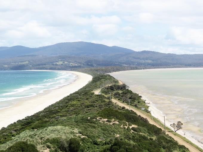
Previously, we'd only walked a few kilometers from the ferry dock on our mini on-foot excursion. We hoped today to cover all the roads, paved and gravel, that criss-cross the island. It actually looks like two islands on the map, separated by a narrow isthmus called The Neck. We headed there first.
 This area is a blue penguin aka fairy penguin rookery with blinds for watching the penguins go to and from the sea each day at dawn and dusk. The timing was wrong to see the bluies, but we did climb the wooden stairs to the top of the hill for spectacular views of both sides of the Neck...D'Entrecasteaux Channel on one side and the Tasman Sea on the other. There is also a memorial to Truganini, the last Tasmanian Aborigine who died in 1876 after a miserable life at the hands of the violent white settlers.
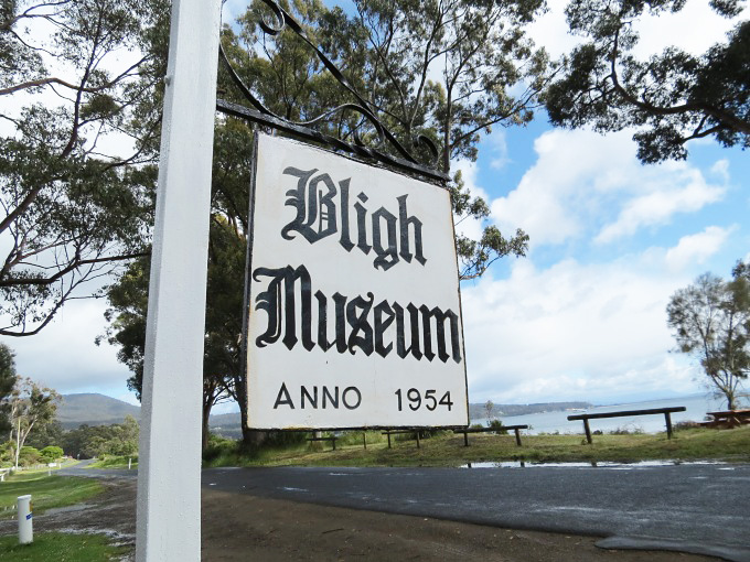
 We headed down the east side of south Bruny to Adventure Bay. We had read about the Bligh Museum and stopped in for a look. If you're interested in early explorers of Tasmania, this is the place to visit. All manner of information and memorabilia about Tasman, Furneaux, Bligh, D'Entrecasteaux, Flinders and of course, our hero, Captain James Cook. All of these early navigators found refuge here in Adventure Bay. There's a very lackluster monument to Captain Cook in an overgrown nook beside the road and a stone marker where he supposedly left a copper plaque on tree showing he visited. We had hoped to take some hikes during the course of the day, but high winds, cold temps and frequent showers thwarted our plans a bit. We were glad we were in the van.
 The road ends at Adventure Bay, so we backtracked a bit and took a quick 15 minute walk through the Mavista Reserve. This area is rain forest and true to its name, it did rain about every 10 minutes or so. The trees were dripping; the trail was muddy; thick foliage and ferns were glistening with raindrops.
 Across the island, we traveled through scenic little villages like Lunawanna and Alonnah … together those town names are what the Aborigines originally called Bruny Island. We headed south to Cape Bruny Lighthouse which is part of South Bruny National Park. The views along the way, especially at Mabel Bay, were stunning.
 At the Cape Bruny Lighthouse, we wimped out when greeted by 40 knot cold winds blowing and rain pelting down. We waited for nearly an hour while picnicking on cheese and apples in the van. The sun would peek out for a minute or two, but the wind and cold did not abate and thus the lighthouse was not given any closer inspection.
 Our birdwatching netted us superb fairy wrens, New Holland honeyeaters, eastern rosellas, a flame robin and a spotted pardalote plus innumerable Tasmanian native hens which roamed about the island like feral chickens.
The island is about 100 km from the northern point to the southern tip. Though the coastal areas are mostly rugged, the interior is rich and verdant. Farms, fruit orchards and grazing stock abound. We saw Australia's southernmost vineyard, cheese shops, berry farms, an oyster shack and a smoked salmon outlet. The Bruny Islanders are an ambitious lot.
 We retraced our route and headed to Dennes Point on the very northern tip of North Bruny. This was an especially pretty little place with lots of little coves and possible anchorages along the protected channel side of the island. We checked out Barnes Bay which looked to be a very protected anchorage for our impending visit.
An absolutely lovely day, despite wind and rain. Oh, and did I forget to mention? I got my birthday wish. Just in case, you're wondering. This guy was NOT penned up. He had jumped INTO a farmer's paddock with a couple of buddies and was munching some lunch.


