Hiking at Red Rock Canyon
/Shame on us! Having lived here in Las Vegas for more than two years, we discovered that less than an hour west across town, there’s a beautiful national conservation area … Red Rock Canyon. Administered by the BLM (Bureau of Land Management for non-US folk), this 200,000 acre natural world in the Mojave Desert is rich in desert wildlife, stunning scenery and geologic wonders … not to mention lots of hiking trails and more than 2,000 rock climbing routes. In fact, it’s one of the top five climbing destinations in the USA. Who knew?
The park map showed lots of hiking opps for easy, moderate and difficult levels.
Though David was a rock/mountain climber in the past, climbing is not on our ‘to-do’ list nowadays. After a little research, however, hiking in the Calico Hills seemed very appealing. We arrived in the early afternoon wondering if there’d really be enough to do for a day or two. After exploring a bit, we determined there’d be enough to do here for a week or more and then we could probably do it all over again and it would seem a whole different experience.
A roadrunner welcomed us to the Red Rock Canyon Campground.
We checked out the Visitor’s Center first to get a map and the lay of the land. We skipped back down the highway a couple of miles to snag a campsite at the Red Rock Canyon Campground, the BLM’s only campsite in the area. Why not? We figured finding a campsite on a weekday in October would be easy pickings. How busy could it be? Well, to our surprise, it was pretty much full! Summer is too hot for camping here. Autumn, winter and spring are prime times. We claimed an adequate, not great, spot. This is desert camping … plenty of room, but dry, parched land dominated by Joshua trees, mesquite, cacti and yucca all around us.
Yucca certainly dominates the views here.
We headed back to the park to drive the 13-mile Red Rock Canyon Scenic Loop. We saw signs for tortoise crossings and hoped to see a tortoise or two, but never did. We stopped at several overlooks to take in the views and with the aid of the park map and our All Trails app, we finally decided on a hiking plan for the next day.
The moon set on top of White Rock while driving the Scenic Loop
We were back in the campground by 4:30 pm, sitting comfortably in our camp chairs, sipping wine and enjoying balmy, 70F+ temps. We forgot how early the sun sets now and just how quickly ‘balmy’ turns to downright cold once the sun disappears. David had a roaring fire going, but by 7:30PM, we retired to Blue, chilled to the bone. Short daylight hours (~10.5) make for very long, dark, cold nights.
It was good to be back in Blue. We spent a comfy, albeit what seemed to us to be a never-ending night. We were awake while it was still pitch black outside, drinking coffee and chatting about Blue’s continued upfit, plans for the day’s hike, upcoming trips and wondering when the darned sun was finally going to appear. Old Sol finally poked his head up over the hills and within minutes the whole campground was bathed in a warm, golden glow, begging us to enjoy the morning, watch the show and get onto the trail. We willingly obliged.
Morning in the Calico Hills
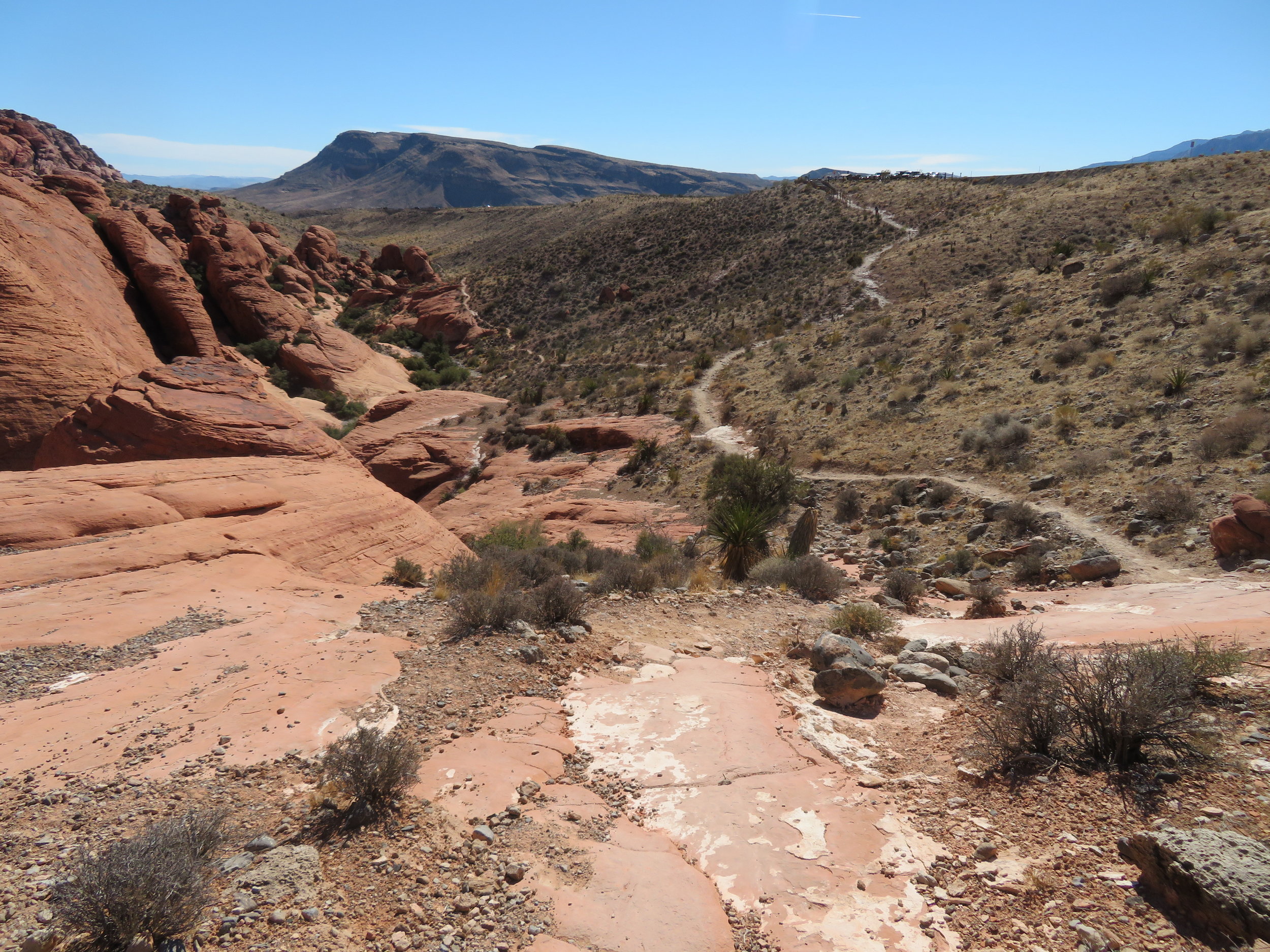
We’d decided on the Calico Tanks Trail, considered moderately difficult and described as ‘uphill sections up to 500’ in elevation gain; uneven terrain and some rock scrambling’. It seemed a good trail to test the proverbial Red Rock Canyon waters and promised ‘sweeping views of the Las Vegas Valley’.
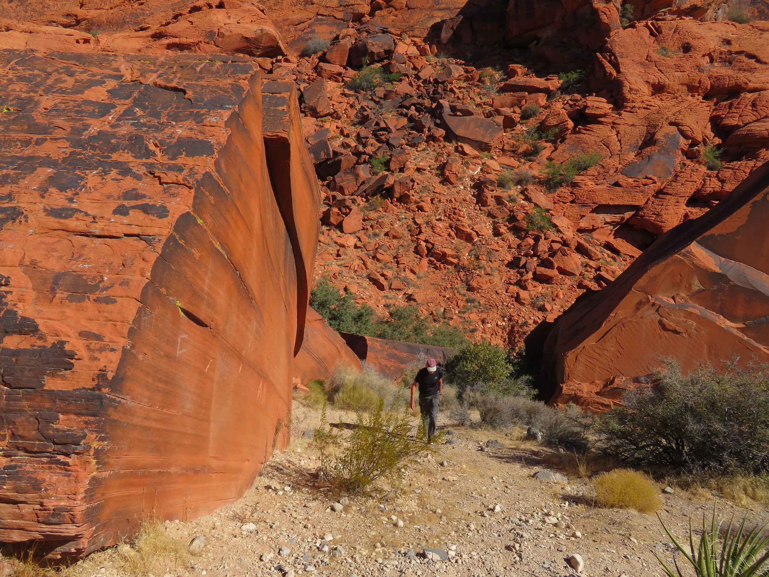
Huge sandstone rocks from the Sandstone Quarry used to be shipped to California for decorative building facades.
Entrance to the trail was at the Sandstone Quarry. Stone quarrying by Excelsior Stone Quarry and other companies was one of the first industries in the Las Vegas area. Ten-ton blocks were cut and loaded onto wagons and transported to LA and San Francisco for decorative building facades. The business was, however, labor intensive and not economical and only lasted from 1905-1912. Just as well, all of the Calico Hills would probably be part of LA by now if the venture had been profitable.
Calico Tanks Trail … right this way!
Though we were prepared for the trail’s minimal elevation gain of 450’ in about 1.5 miles, we (mostly me) hadn’t been bouldering, scrambling or walking on scree and rock for many moons. It took me awhile to gain back my confidence as we maneuvered up and over large, steep rock formations. It was somewhat disconcerting to see the 20-30 year olds gracefully leap from rock to rock, run along the rough, rutted trails and be up to the top and back down by the time I’d negotiated a 50’ section. That said, the walk/climb was awesome and the view from the top was worth the effort. As always, coming down was much easier and faster than climbing up.
The view of the Las Vegas valley from the top of the Calico Tanks trail was worth the effort of the climb.
After a relaxing picnic lunch at Willow Springs, we headed to the LaMadre Spring, another moderate-rated trail touted as ‘a great place for wildlife viewing, including bighorn sheep’. The trail began on an old rutted, rough-gravel 4x4 road that hadn’t seen any grading or maintenance for a long, long time. The trail forked off onto gravel and scree … hard walking … and was a gradual incline up, up, up. We huffed and puffed a bit, but had no trouble making it to the ‘spring’ which we could hear, but not quite see. Other than a couple of lizards, no animals were in view, but again the scenery was gob-smacking.
No animals were sighted at La Madre Spring, but the trail views were gob-smacking!
We were back at camp by around 4:30pm. It had been somewhat breezy at the park, but back at the campground it was gusty and dusty. We debated on a campfire, but decided the wind was just too much to maintain a safe fire. Even with its windscreen in place, the Coleman propane stove had a hard time with the wind whirling around, and we ended up standing in front of it to shield the flame from the wind so we could heat our beans and franks for dinner. We huddled on the Blue’s lee side to get out of the cold wind while eating.
When the sun went down, so did the temperature and without a fire, we retreated to Blue by 6PM. Another very long, dark night accentuated by Blue shivering and shuddering as the wind howled till the early dawn. We headed back to the park early for another day of hiking.
Swirls of sandstone along the Calico Hills trail
The Calico Hills are appropriately named because of their distinctive three colors: red sandstone, yellowish white limestone and brown/gray granite … similar to the coloring of a calico cat. Aztec sandstone, ‘fossilized cores of old sand dunes laid down during the early Jurassic period (180-190 million years ago)’, gets its brilliant red color from iron oxide deposits. White limestone is the calcified remains of sea life of the Paleozoic era Panthalassic Superocean that once covered nearly 70% of the Earth’s surface including the Mojave Desert.
The Calico Hills trail was sheer pleasure to walk.
The Calico Hills trail was a pleasure to walk. It climbed and dipped following the terrain along the edge of the tri-color escarpment. The early morning light played with the rock shapes … interesting shadows here, glowing red rock there. We watched rock climbers scuttling up the rock faces and belaying themselves down.
A rock climbers paradise
Interesting rock formations all along the trail added to an already pleasurable experience.
Pretty stunning scenery, wouldn’t you say?
The 7-mile roundtrip hike was absolutely perfect and left us wanting more of Red Rock Canyon. We didn’t see any tortoise or wild burros or chuckwallas, but we did see a few animals. Take a look.
We’ve decided that one or two hikes or overnight camping trips a week will be a perfect way to discover more of nature’s playground close to home and stay in shape. What’s next? Stick around and find out.
Check out another hike at Red Rock Canyon here.


