Exploring St. Helena - pt. 2

The Bellstone, Halley's Mount and Diana's Peak National Park

The days here have been warm, but mostly overcast. Sometimes in the afternoon, the sun peeks through for a few hours. When we left for Diana's Peak National Park, it was overcast here in Jamestown and by the time we climbed to the higher altitudes, it was misty, thick with low lying clouds. We opted to take a little detour down to Levelwood, on the southeast corner of the island, in hopes that the day would clear. We were in search of the Bellstone, “a trchyandesite boulder that rings (like a bell) when struck.” Hmm. We found the boulder enclosed in a little fenced area and sure enough, when David struck it with a nearby rock, its sonorous tone rung out like a bell. There are evidently more boulders like this in the area, but one was enough. The day was clearing and we headed to Diana's Peak.

bellstone on st. helena island

As we made our way back to the national park entrance, the mist descended once again. The sun was teasing us. We saw a sign for Halley's Mount and decided to climb it. We traipsed up a grassy trail lined in flax and found the foundation of the observatory on the top of the hill.  Edmond Halley was only 20 years old when he visited St. Helena Island in 1677. He was commissioned to catalogue the stars in the Southern Hemisphere in order to correct astronomical tables then in use. St. Helena offered several advantages. It was a British colony and it was far enough into the Southern Hemisphere to view the southern stars, but still close enough to the equator to view the northern stars as well. The disadvantage? Like today for us, the skies were frequently overcast so his viewing time was challenged. He observed the transit of Mercury across the sun while he was here in an effort to measure the distance of the Earth from the sun.

halleys mount st. helena island

The sun was peeking out again as we made our way to the entrance to the national park. We could delay no longer if we wanted to make the walk. We chuckled in amazement at the cows grazing on the steep, terraced hillsides. They seemed all a-tilt, but certainly content enough as they munched away.

terraced cows on st. helena island

The road to Diana's Peak was unsurprisingly steep, narrow and winding. We parked off the road on a hillside and made our way up the Cabbage Tree Road, a broad grassy path that was wet with mist and lined with overhanging Black Cabbage trees. Yes ... the soaking mist had returned.

dianas peak sign

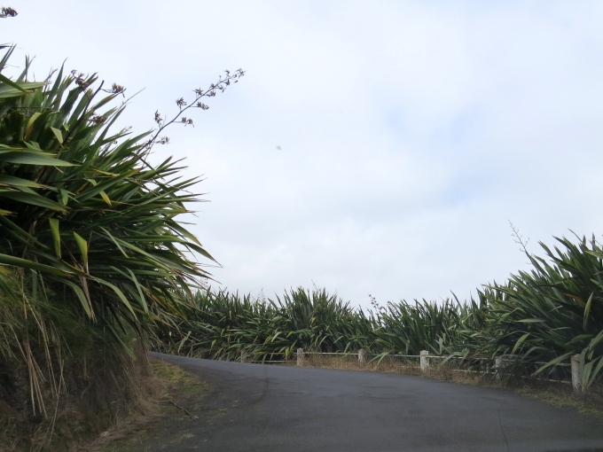
The trail itself was now wet and slippery in spots. Bare spots were turning muddy. Up, up, up, we tramped, switchbacking back and forth with tall, green flax lining both sides of the trail.

flax on the hill in st. helenas island

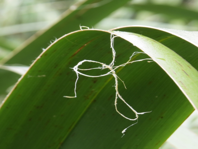
In days past, flax was a big industry on St. Helena and New Zealand flax was planted in every available area. The flax was harvested and processed for rope-making. The advent of nylon rope, however, killed the industry and though the flax remains, the flax harvesting has long since passed, other than for crafts.

sth4_close up flax

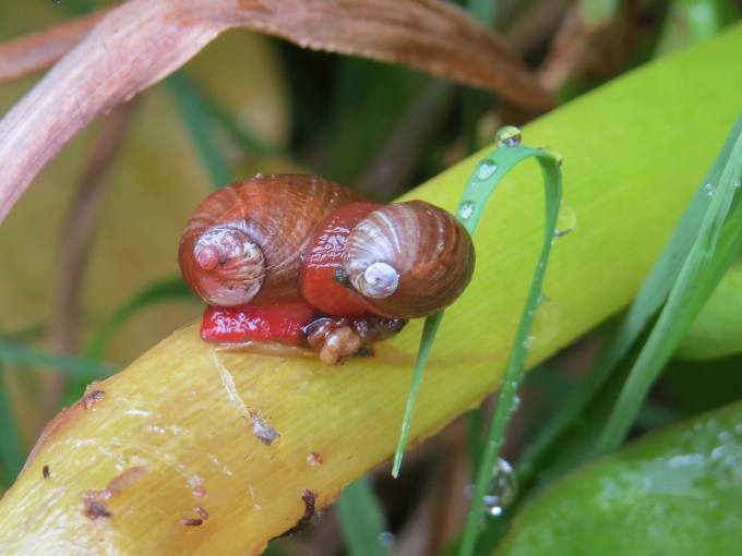
As we trudged further and further up the hillside, we noticed a definite change in vegetation. This area of St. Helena is home to significant endemic flora and fauna. There are no snakes on St. Helena, but there are 33 species of spiders, 22 of which are endemic. Several of them live in this area and thought rare, I was not particuarly looking forward to meeting any of them...and we didn't. We did spot endemic blushing snails though. Some were mating … blushing snail bliss.

blushing snail bliss

The area was green and lush, the plants making the most of this misty day. There are 50 endemic plants and ferns here. The tree ferns, in particular, reminded us of our time in New Zealand.

tree ferns on st. helena island

We continued upwards and came to a sign for Diana's Peak Road. Wood-framed dirt-filled steps aided our ascent.

dianas peak trail marker st. helena island

The higher we climbed, the thicker the mist became. From a distance we could see  Actaeon Peak, distinguished by the large Norfolk pine growing directly from its peak. This peak is also known as Cuckold's Point and we knew immediately why it had been named as such.

cuckolds point at st. helena island

By the time we reached the summit of Actaeon, Diana's Peak was nowhere to be seen. It was off somewhere in the distance, but we certainly couldn't figure out where. It was getting late and we chucked it in. A great walk, but certainly not for the vistas.

dianas peak view st. helena island

As always, we were down much faster than we had climbed. It was after 3pm, but we thought we'd make a quick foray down to Blue Hill, home of the Donkey Sanctuary. For years, donkeys were the key work animal on the island and provided a means of transportation for the up-country Saints. When they were replaced by mechanized equipment and cars, they were gathered together and live now quite peacefully in a pasture area of Blue Hill. They're still used for transporting endemic plants to the High Peak in the island's efforts to restore fragile ecosystems.

donkey sanctuary on st. helena island

Another full day on St. Helena and there was still so much to see and do. We caught the last ferry (6PM) back to Cups for dinner and a movie aboard. We needed to recuperate and be ready for another day ashore. Whew! We'll need a vacation from our vacation.

Exploring St. Helena - pt. 1

Half Tree Hollow, St. Paul's and Sandy Bay

We're leaving St. Helena after a much-too-short visit. There's still so much to tell you and share with you about this incredible place. So … we'll intersperse the rest of our St. Helena adventures with passage notes continuing across the Atlantic.

And, yes, there's been a change of plans. What else is new? We've decided to give Ascension Island a miss this time across. We visited back in 2007 and we'll reminisce a bit for you as we near the island, but instead of stopping, we'll continue straight on to French Guiana.  And now … on to our regularly scheduled programming.

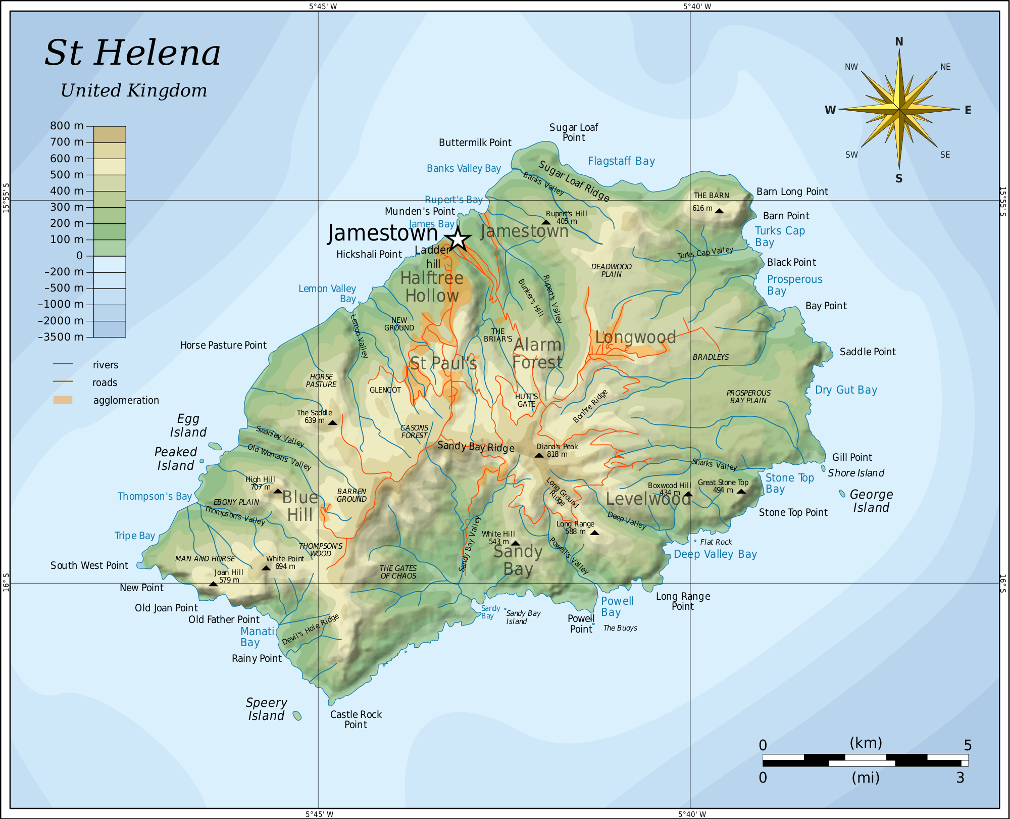
I perused and studied all those brochures I'd collected at Tourist Info and we came up with a good plan to explore the island. St. Helena is only 47 sq. miles and there aren't that many roads; we intended to drive on most, if not all of them. The island is divided into eight separate areas with wonderful names like Half Tree Hollow, Alarm Forest and Levelwood and geographical names like The Gates of Chaos, Man and Horse, Lot and Lot's Wife and Prosperous Bay Plain. With our excellent St. Helena Visitor's Guide, we headed out early to pick up our hire car.

map of st. helena island

We had a bit of a rocky start. The car was delivered with less than a quarter tank of gas which required another trip to the bank for more cash since the petrol station only accepts cash and petrol is about $7.30/gallon. Then we managed to lock the keys in the car. Don't ask … it was a comedy of errors that was soon sorted out and we were on our way up Napoleon Street with a hire car and a tank of gas, heading out of town.

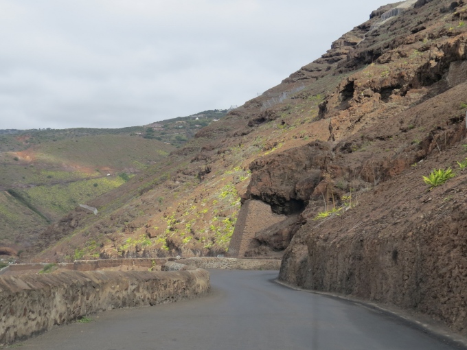
It's all up, up, up or down, down, down here. There seems to be no in-between … no level ground. Most of the roads are paved, but they're winding, narrow, single lanes with sharp switchbacks to negotiate the mountainous terrain. We can't imagine how hard it was to build them because driving on them is not easy nor for the faint-hearted.

winding roads of st. helena island

Our first stop was the Boer Cemetery. During the Boer Wars (Brits versus Boers in South Africa – 1900-1902) over 6,000 captured Boer prisoners were sent to St. Helena for internment. The conditions were difficult, but the prisoners made the most of their time here working in agriculture and skilled trades. Within their barbed wire confines, they held their own events, published their own newspaper and even operated their own little businesses. Many died and are buried here on a steep, grassy hillside in St. Paul's. The ages ranged from 16 to 61. We wandered midst the white stones, listening to the wind rustle the leaves and the birds singing cheerily and wondered about these soldier's stories.

boer cemetary on st. helena island

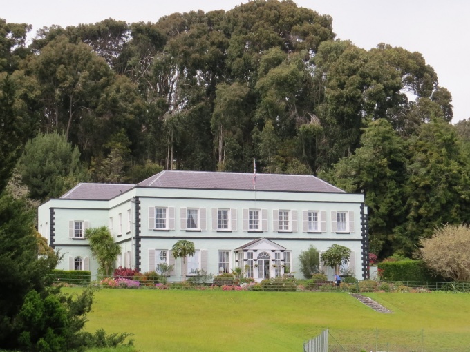
We headed next to Plantation House, home of the resident Crown-appointed Governor of St. Helena. This gracious Georgian-style mansion was built in 1792 by the East India Company as a country residence for the island's governors and remains so today.

plantation house on st. helena island

Its spacious front lawn is also home to St. Helena's oldest resident, Jonathan, the tortoise. A native of the Seychelles, records indicate that Jonathan probably arrived as a gift in 1882 when he was already about 50 years old. He has company these days. We saw three other tortoises roaming around and there are said to be two more for a total of six … David, Emma, Myrtle, Fredericka and Speedy and, of course, Jonathan. A caretaker pointed out Jonathan for a photo opp.

jonathon tortoise of st. helena island

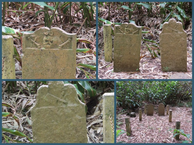
There are several pleasant walks near the Plantation House grounds. We took a short one to the Butchers graves. There are conflicting stories about the Butchers, but it appears they were slaves at Plantation House. Margaret's sandstone gravestone bears a skull with flowers on its head along with bones and arrows. Her husband, Francis, was a butcher (hence the name) and his gravestone bears a cleaver.

butcher gravestones on st. helena island

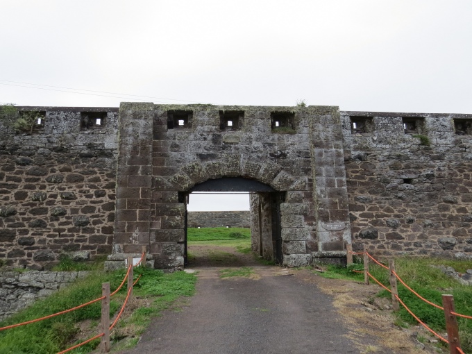
We headed over to High Knoll Fort next, a massive undertaking begun in 1798 and improved throughout the years, with its outer defensive walls and main gate completed in 1874. We spent the better part of two hours here and it really deserves a blog post of its own, so I'll leave the descriptions and more pics for later. It's quite a fascinating place.

high know fort on st. helena island

We continued south across the island with a stop at picturesque St. Paul's Cathedral. Built in 1851, this 19th century country church is absolutely beautiful in its setting and simplicity. The grounds around and above it hold the remains of past parishioners. We met and chatted with Mouse, a gravedigger, who was waiting for the remains of a Saint who had died in the UK and whose body had come home aboard the RMS St. Helena to be buried.

st. pauls church st. helena island

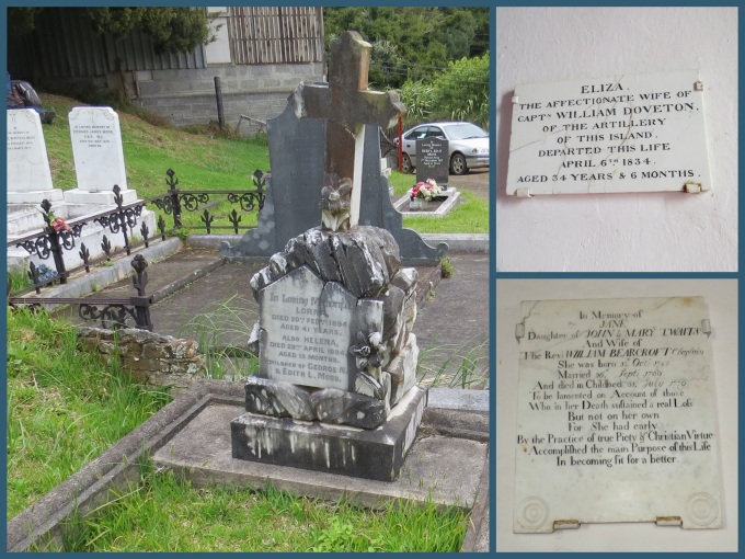
There were commemorative plaques on the walls of the church dating back hundreds of years. We took the time to read some of the gravestones and wondered sadly how the Moss family must have mourned for their two daughters Lorna (4-1/2 years) and Helena (15 months) who had died within months of each other in 1894 and what had caused this tragedy.

st. pauls gravestones st. helena island

We headed over to Sandy Bay, the island's only beach. The road to get there was gravel and very rutted, not to mention steeper than we'd previously experienced. The views, however, were superb, especially the rock formations, Lot (foreground) and Lot's Wife ...

lot and lots wife

and looking down into the Sandy Bay Valley.

sandy bay valley

The tiny Sandy Bay Baptist Church still holds regular services.

sandy bay baptist church

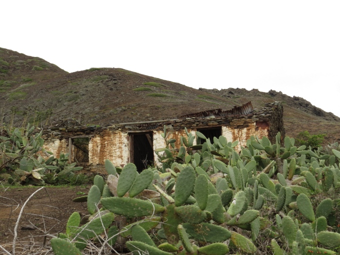
This is a dry area of the island and prickly pear grows profusely. We passed an old house, long since abandoned that made a great photo opp. By the way, we learned that the locals make an alcoholic drink called tungi (toongee) from prickly pear. Haven't tried it yet, but it's on the list.

old house with prickly pear

We're told Sandy Bay is a dangerous beach with strong currents and undertow, but we had no plans to swim in the cold Atlantic waters. We took a quick peek at the beach, but a cold wind was blowing and the day was waning. We needed to head back across the island.

sandy bay beach st. helena island

We're just starting to explore, so stay tuned for more St. Helena adventures.